1. Changing River Environments
1. Changing River Environments
-
1.1.1 Characteristics of rivers and drainage basins: the long profile, width, depth, speed of flow/velocity, discharge, wetted perimeter, channel, watershed, tributary, confluence, source, mouth.
1.1.2 The Bradshaw model.
1.1.3 How the drainage basin operates within the water cycle.
1.1.4 Processes which operate in a drainage basin: precipitation, interception, infiltration, percolation, overland flow, channel flow, throughflow, groundwater flow, transpiration, evaporation, evapotranspiration.
1.1.5 Processes which operate within a river:
• erosion; hydraulic action, abrasion, attrition, solution
• transportation; traction, suspension, saltation, solution
• deposition. -
1.2.1 The characteristics and formation of landforms: waterfalls, rapids, gorges, V-shaped valleys, meanders, oxbow lakes, levées, floodplains, deltas, interlocking spurs, potholes
-
1.3.1 The opportunities and hazards of living near a river.
1.3.2 The human and natural causes of river flooding.
1.3.3 The impacts of river flooding.
1.3.4 An evaluation of the strategies and techniques used to manage river flooding; including sustainable.
1.3.5 The human causes of river pollution.
1.3.6 The impacts of river pollution.
1.3.7 An evaluation of the strategies and techniques used to manage river pollution; including sustainable.
1.3.8 One detailed specific example to include:
• the causes and impacts of a flood for a named river
• the strategies and techniques used to manage the flooding of the river; including sustainable.1.3.9 One detailed specific example to include:
• the causes and impacts of pollution in a named river
• the strategies and techniques used to manage pollution levels in the river; including sustainable.
1.1 The main hydrological characteristics and processes
1.1.1 Characteristics of Rivers and Drainage Basins
What is a drainage basin?
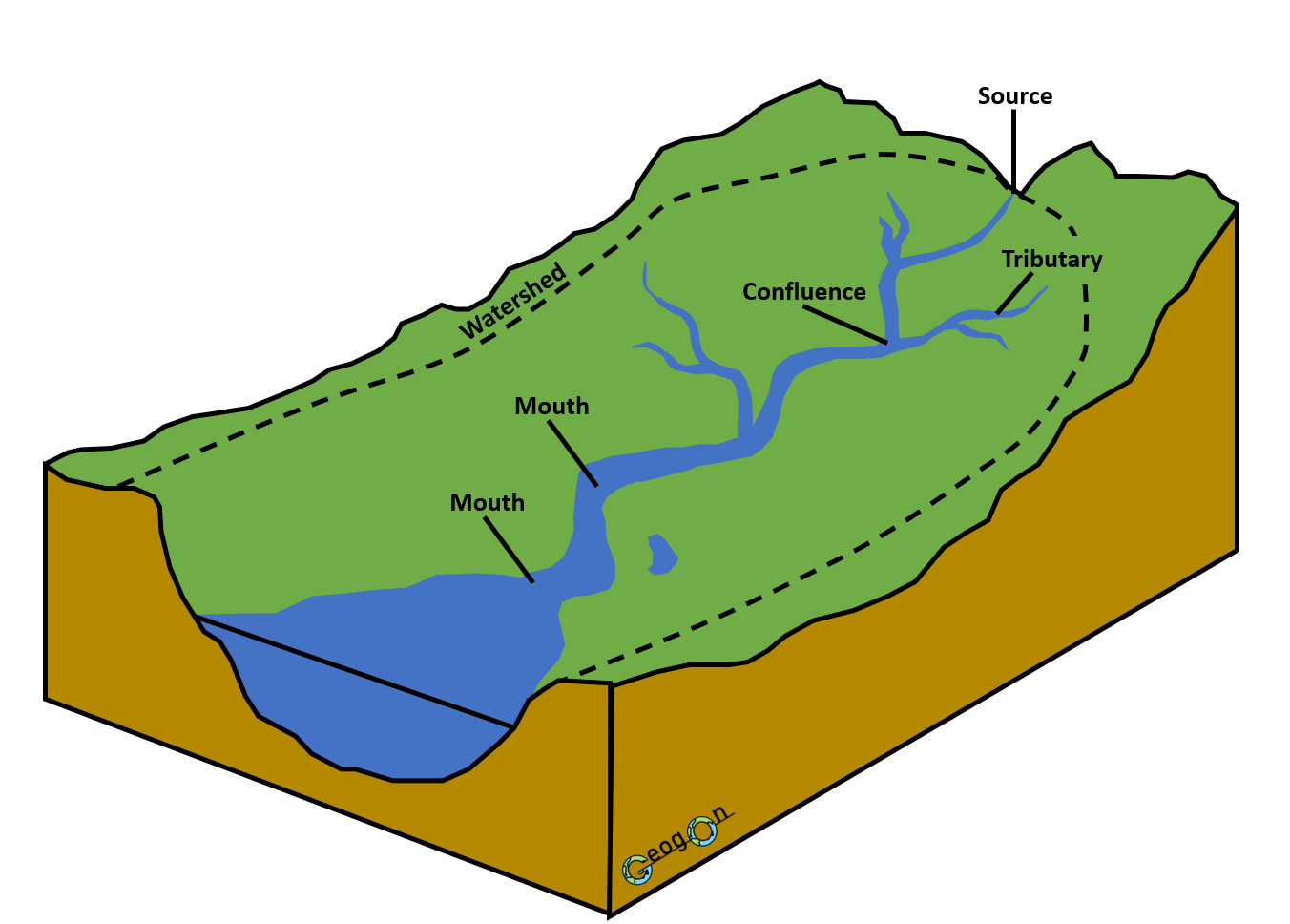
A drainage basin is the area of land drained by a river and all of its tributaries.
Water falling anywhere inside the drainage basin will eventually move towards the main river, unless it is stored, evaporated or removed in another way.
The edge of a drainage basin is marked by a watershed. Watersheds usually follow areas of higher land such as hills or ridges.
Remember:
The drainage basin is the whole area being drained.
The watershed is the boundary around it.
Source
The source is the place where a river begins.
Sources are commonly found in upland areas where rainfall is high. Water may enter the river from springs, surface runoff, melting snow or smaller streams.
Channel
The channel is the physical area through which the river flows.
Bed – the bottom of the river
Banks – the sides of the river
Confluence
A confluence is the point where two rivers or streams meet.
After a tributary joins the main river, the greater volume of water usually causes discharge to increase.
Watershed
A watershed is the line of high land that separates one drainage basin from another.
Rain falling on opposite sides of a watershed will flow into different river systems.
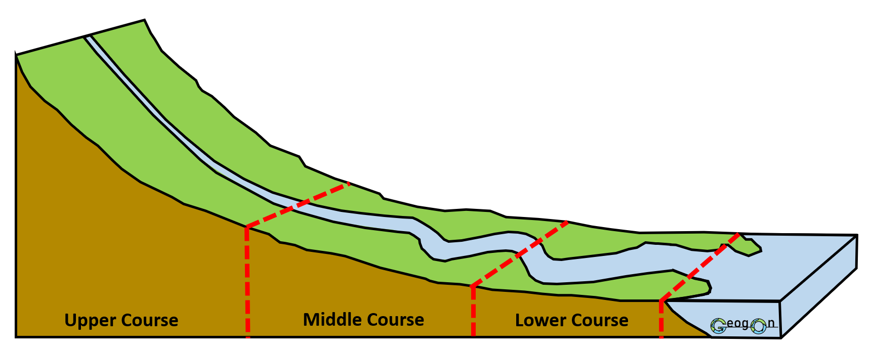
Why does the gradient decrease downstream?
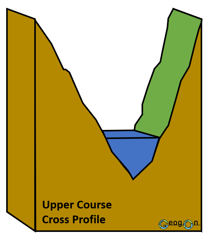
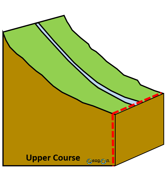
In the upper course, the river flows across steep upland landscapes and vertical erosion can cut downwards into the valley.
Further downstream, the river is much closer to its base level. Vertical erosion becomes less important and lateral erosion, transportation and deposition become increasingly significant.
This produces the characteristic smooth, concave long profile of a river.
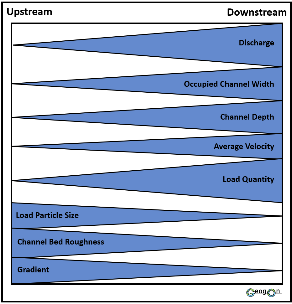
The Bradshaw Model shows how the characteristics of a river generally change as it moves downstream from its source towards its mouth.
Generally increase downstream:
Discharge
Channel width
Channel depth
Average velocity
Load quantity
Generally decrease downstream:
Gradient
Channel bed roughness
Load particle size
These changes occur because tributaries add more water, increasing discharge, while erosion makes the channel wider, deeper and smoother. River sediment also becomes smaller and rounder through attrition.
Remember: The Bradshaw Model shows a general pattern. Real rivers may not follow it perfectly because local geology, human activity and changes in rainfall can affect river characteristics.
River processes
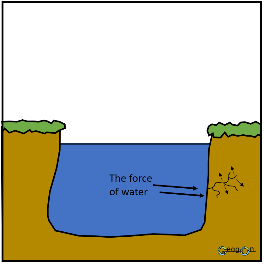
Hydraulic Action
Transportation
Transportation is the movement of eroded material, known as the river’s load, downstream.
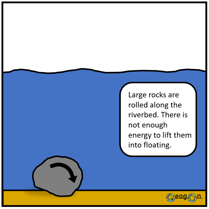
Traction – large rocks and boulders are rolled along the river bed.
Saltation – smaller stones and pebbles bounce along the river bed.
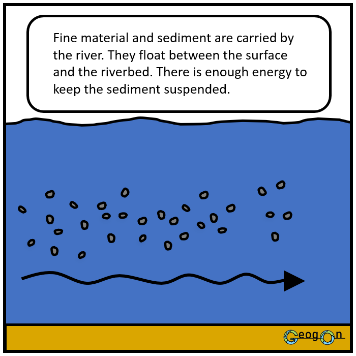
Suspension – fine particles such as silt and clay are carried within the water.
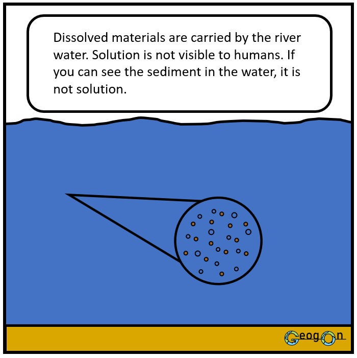
Solution – dissolved minerals are carried within the water.
The amount and size of material a river can transport generally increases when velocity and discharge increase.
Abrasion
Suspension
Deposition
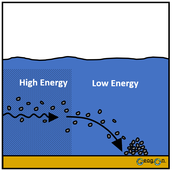
Deposition happens when a river loses energy and drops the material it is carrying.
This can happen when:
river velocity decreases
discharge decreases
the gradient becomes gentler
the river enters a lake or sea
the river becomes shallower or spreads out
there is an increase in friction
The largest and heaviest material is deposited first, while finer sediment can be transported further downstream.
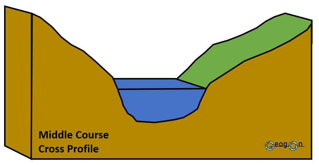
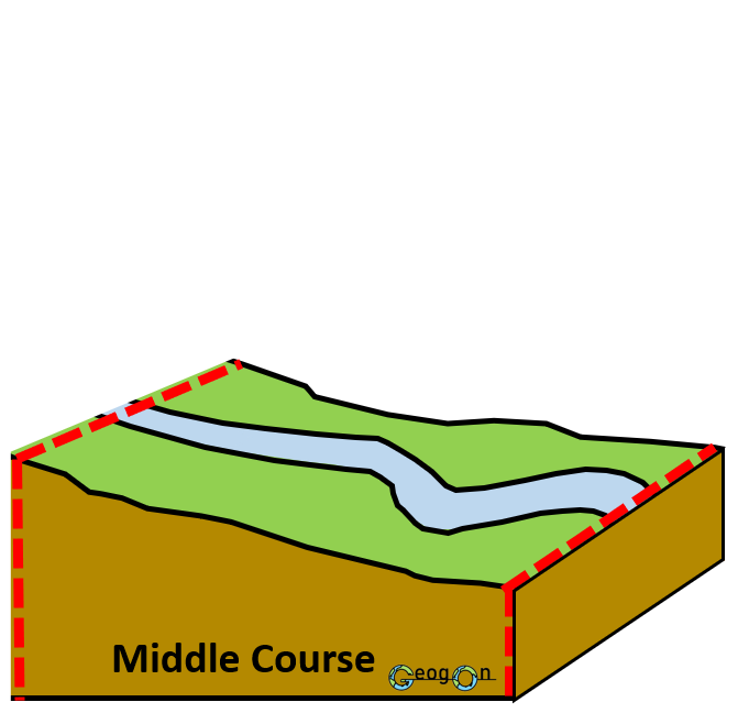
Mouth
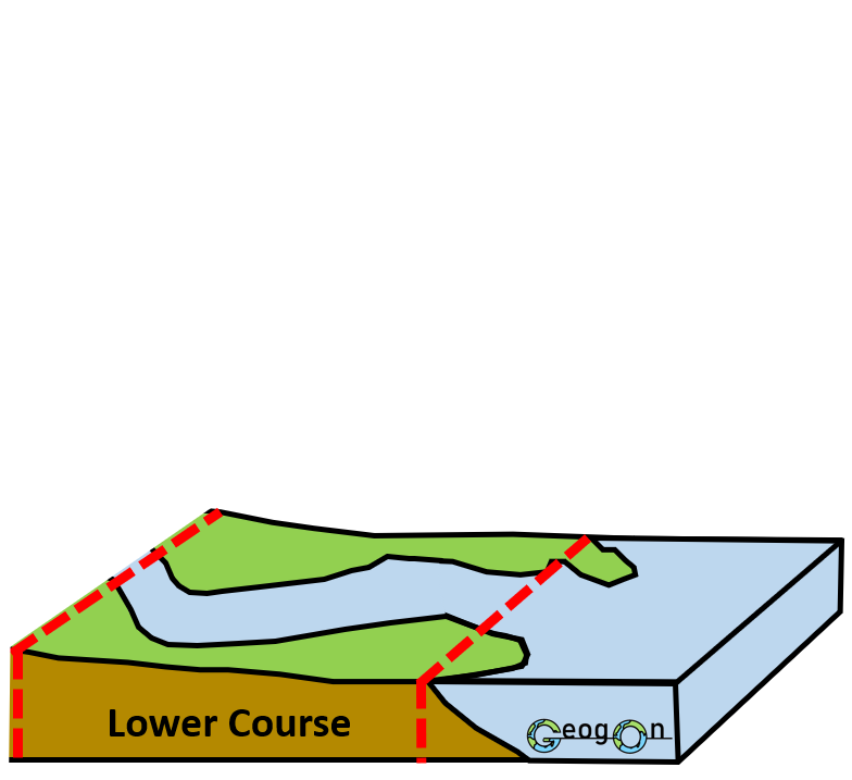
The mouth is the end of a river where it flows into another body of water, such as a sea, lake or larger river.
By the time a river reaches its mouth it normally has a much greater discharge than it had near its source.
Vertical erosion:
Erosion that cuts downwards into the river bed, making the channel deeper.
Lateral erosion:
Erosion that cuts sideways into the river banks, making the channel wider.
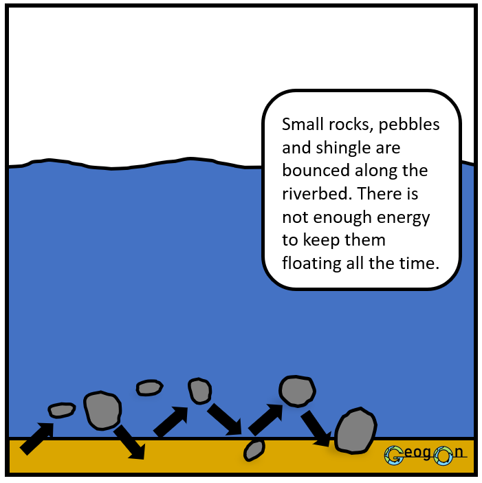
Saltation
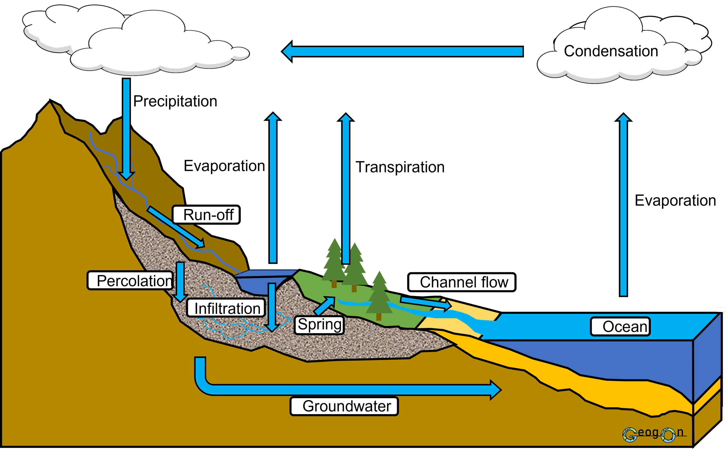
The water cycle is the continuous movement of water between the atmosphere, land and oceans. A drainage basin forms part of this cycle, transferring and storing water as it moves towards a river channel.
Key processes
Precipitation – water falling from the atmosphere as rain, snow, sleet or hail.
Interception – precipitation caught and temporarily stored by vegetation before reaching the ground.
Infiltration – water soaking from the ground surface into the soil.
Percolation – water moving downwards from the soil into underlying rock.
Overland flow / surface run-off – water flowing across the land surface towards a river.
Throughflow – water moving sideways through the soil towards the river channel.
Groundwater flow – the slow movement of water through saturated rock towards the river.
Channel flow – water moving within the river channel towards the mouth.
Evaporation – liquid water changing into water vapour and returning to the atmosphere.
Transpiration – water vapour released from plants through their leaves.
Evapotranspiration – the combined loss of water through evaporation and transpiration.
Condensation – water vapour cooling and changing into tiny liquid droplets, forming clouds.
How it links together
Precipitation enters the drainage basin. Water may then be intercepted, infiltrate into the soil or flow over the surface. It is transferred towards the river by overland flow, throughflow and groundwater flow. Channel flow carries the water downstream, while evaporation and transpiration return water to the atmosphere.
Key distinction:
Infiltration = into the soil
Percolation = down through the soil and rock
Erosion
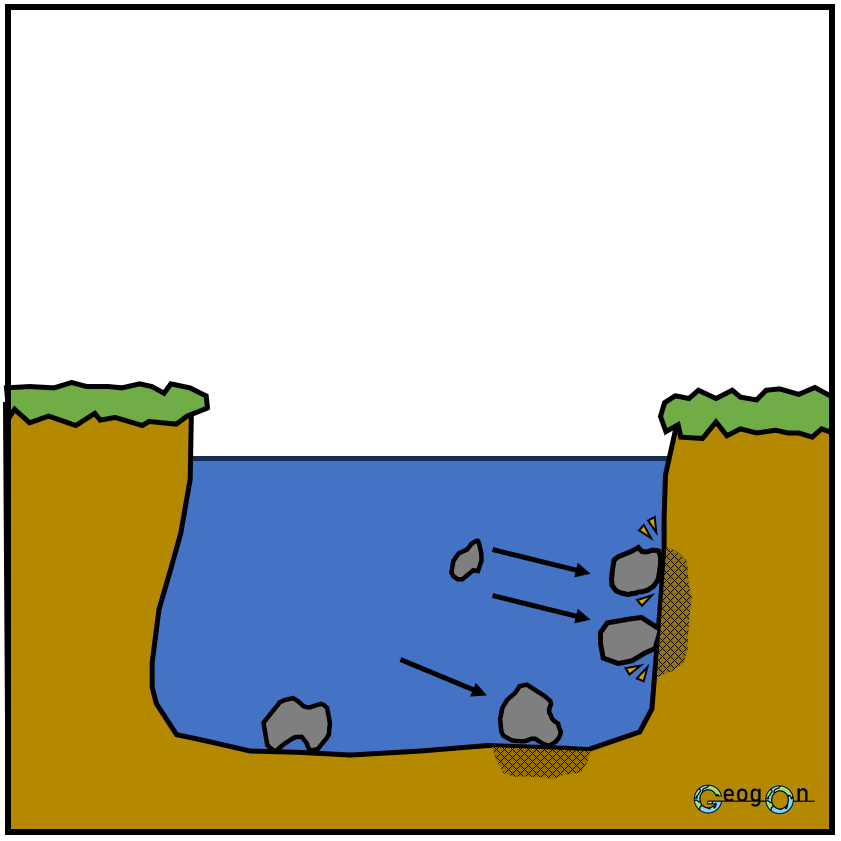
Erosion is the wearing away of the river bed and banks by the force of the water and the material carried by the river.
Hydraulic action – the force of water hits the bed and banks, compressing air into cracks and breaking material away.
Abrasion – rocks and sediment carried by the river scrape against the bed and banks, wearing them away.
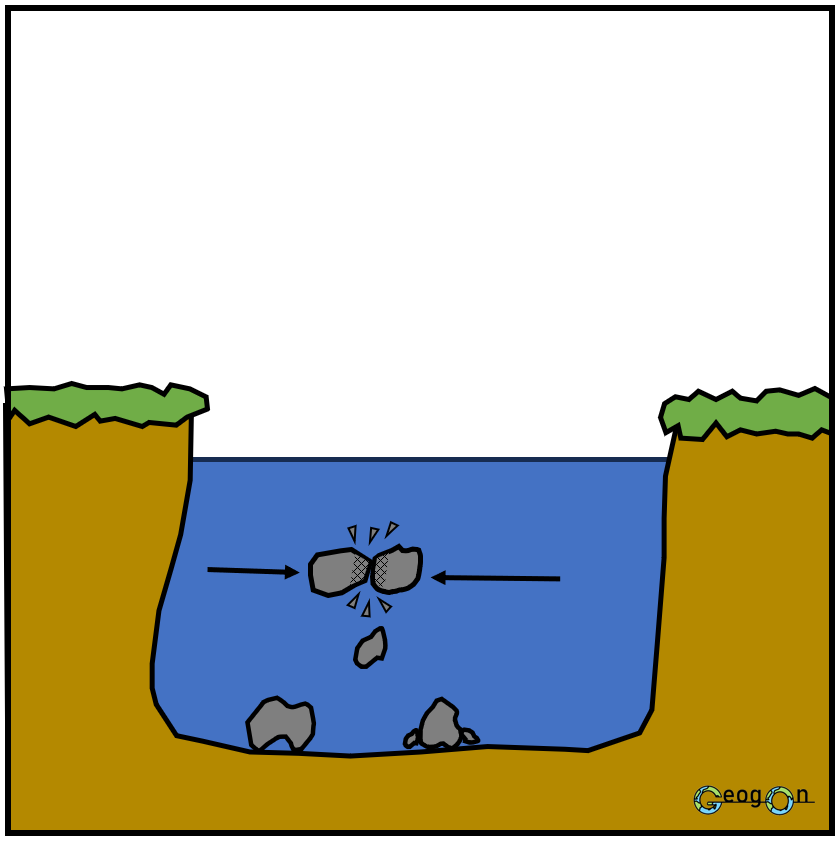
Attrition – rocks carried by the river collide with each other, becoming smaller, smoother and rounder.
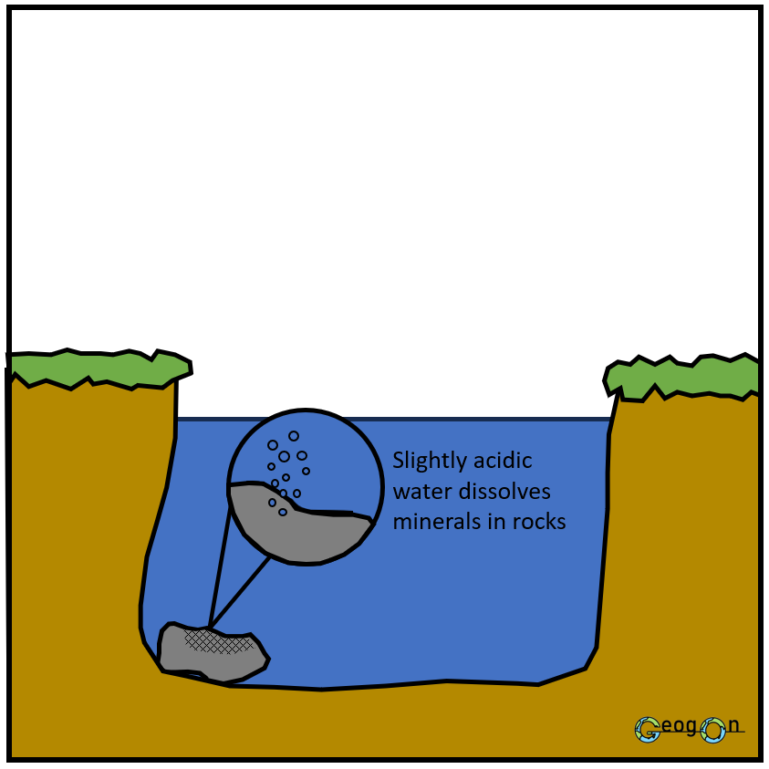
Solution – soluble minerals and rocks are dissolved by the river water and carried away.
Attrition
Solution
Solution
Tributary
A tributary is a smaller river or stream that flows into a larger river.
Tributaries add water to the main river and therefore usually increase its discharge.
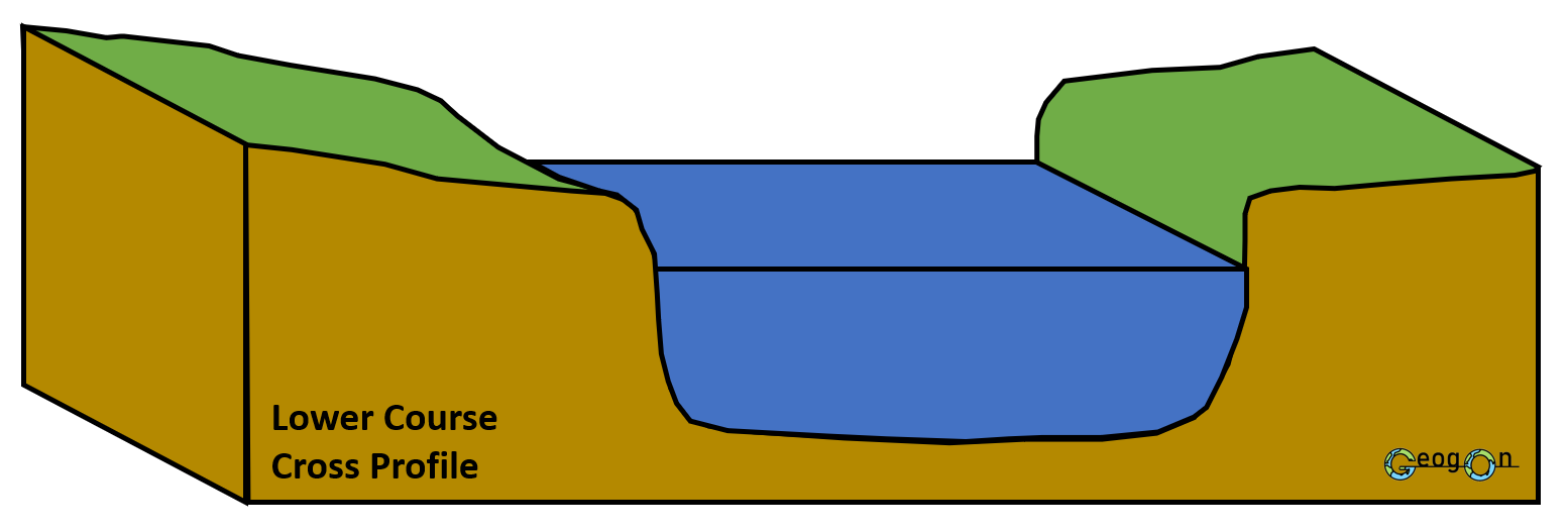
The Long Profile of a River
A river's long profile shows the change in height of the river from its source to its mouth.
Most rivers have a concave long profile.
Near the source:
Altitude is high
The gradient is steep
The channel is usually narrow and shallow
Further downstream:
Altitude decreases
The gradient becomes gentler
The channel becomes wider and deeper
Eventually the river approaches its base level, usually sea level.
Traction
River Channel Characteristics
The characteristics of a river channel change considerably between the source and the mouth.
Width
Width is the horizontal distance across the river channel from one bank to the other.
River width generally increases downstream.
This happens because:
more tributaries join the river
the drainage basin supplying the river becomes larger
discharge increases
erosion enlarges the channel
Depth
Depth is the vertical distance between the water surface and the river bed.
Average river depth generally increases downstream.
The greater volume of water and increased erosion allow a larger and deeper channel to develop.
River depth is not normally the same across the entire channel, so several measurements may be used to calculate a mean depth.
Bradshaw Model
The Water Cycle
River Characteristics and Landforms
River characteristics are the measurable features of a river and its channel, such as width, depth, velocity, discharge, gradient and load. These characteristics change as the river moves downstream.
River landforms are the physical features created by river processes, such as waterfalls, meanders, floodplains and deltas.
The two are closely linked. Changes in characteristics such as velocity, discharge and gradient affect the amount of energy a river has. This controls the balance between erosion, transportation and deposition, which then creates different landforms along the river.
In simple terms:
Characteristics describe how the river behaves.
Processes explain what the river does.
Landforms are the features that result.
Formation of a Waterfall and Gorge
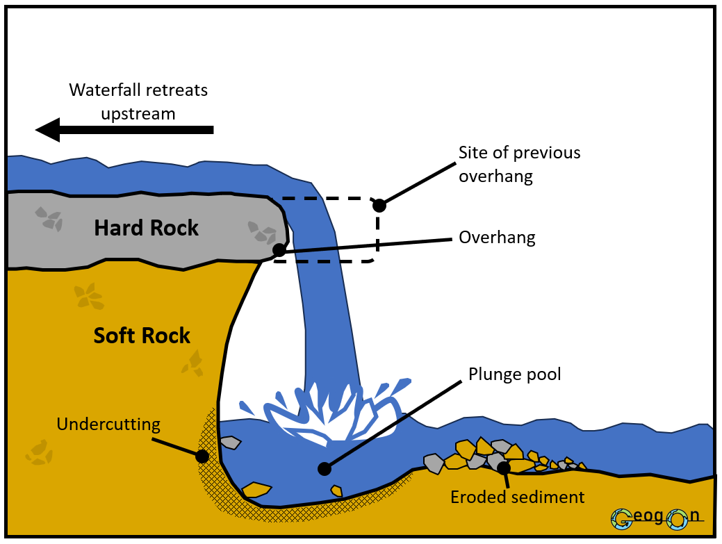
A waterfall is a steep or vertical drop in a river where water flows suddenly from a higher to a lower level.
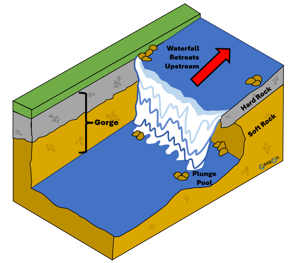
A gorge is a narrow, steep-sided valley that forms as a waterfall retreats upstream.
1. Differential erosion
A waterfall often forms where a layer of hard rock lies above softer rock. The softer rock is eroded more quickly than the resistant hard rock.
2. Undercutting
Hydraulic action and abrasion erode the softer rock beneath the waterfall. This creates an undercut behind the falling water and helps deepen the plunge pool.
3. Collapse of the overhang
As the softer rock is removed, the hard rock above is left unsupported as an overhang. Eventually, it collapses into the plunge pool.
4. Further erosion
The collapsed rock is swirled around by the turbulent water. This increases abrasion, making the plunge pool deeper and causing further undercutting.
5. Waterfall retreat
The process of undercutting and collapse repeats. Each collapse causes the waterfall to retreat upstream.
6. Gorge formation
As the waterfall retreats, it leaves behind a narrow, steep-sided valley called a gorge.
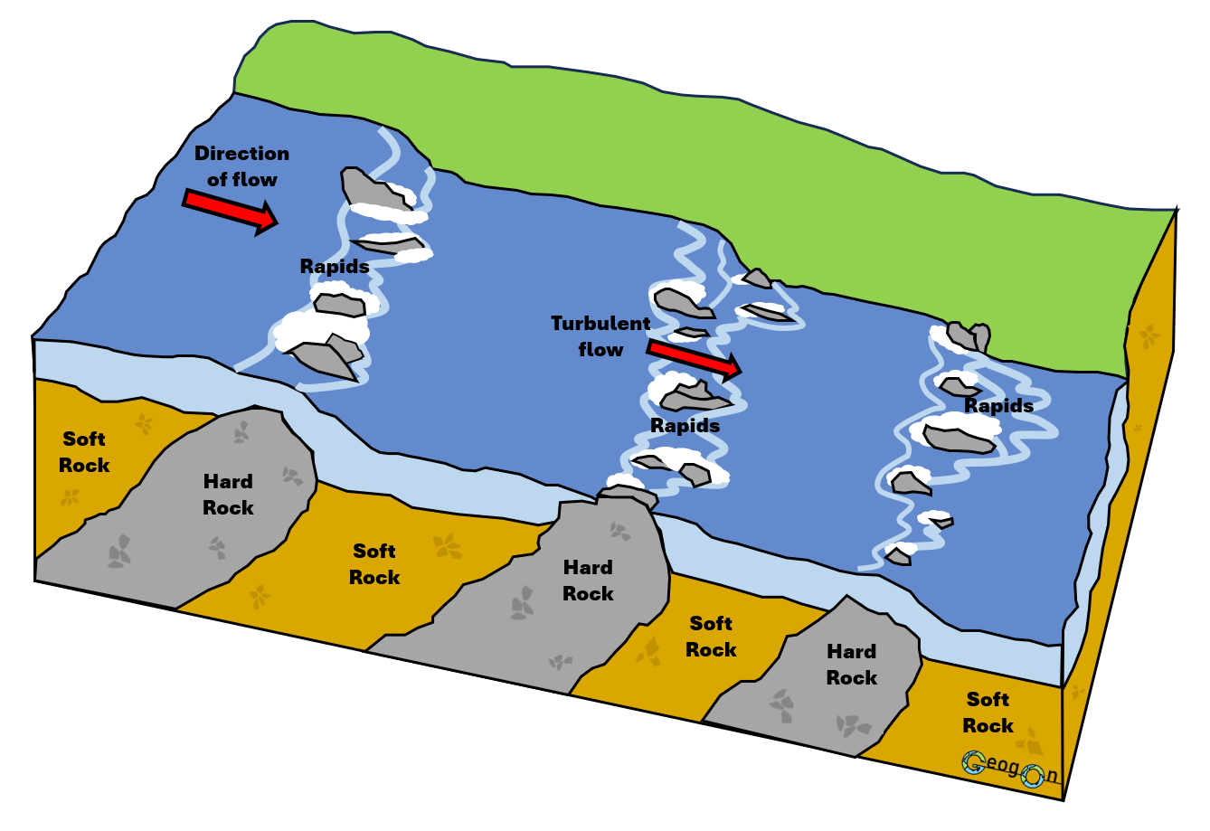
Rapids
Rapids are sections of a river where water flows quickly and turbulently over an uneven river bed.
1. Bands of hard and soft rock cross the river channel
The river flows over alternating areas of more resistant hard rock and less resistant soft rock.
2. Differential erosion takes place
The softer rock is eroded more quickly by hydraulic action and abrasion, while the harder rock resists erosion.
3. The river bed becomes uneven
The hard rock is left standing slightly higher than the surrounding softer rock, creating rocky steps and obstacles in the channel.
4. Water is forced over and around the hard rock
As the river passes over these uneven sections, the flow becomes faster and more disturbed.
5. Rapids develop
The uneven river bed produces turbulent, fast-flowing water, creating the white-water sections known as rapids.